

Editor’s note: This is the first in a series of blog posts exploring the history behind popular Atlanta street names. Is there a street name that you want to know more about? E-mail us at stories@atlantahistorycenter.com, and let us know.
Seventy-one. That’s a current count on how many streets there are in Atlanta that bear the name, “Peachtree.” Of course, the most iconic of the Peachtree streets is Peachtree Street itself, which is relatively synonymous with Atlanta. Some have even called it Atlanta’s Main Street since many of Atlanta’s most prominent historic landmarks line the street. It’s the path for one of the largest running events in the world (Peachtree Road Race) and according to historian Franklin Garrett, letters have made their way to Atlanta bearing just the address “Peachtree Street, U.S.A.”
In downtown Atlanta, it originally began near today’s Five Points junction. Close by that intersection, it met with the rail lines at the city’s original train depot, Union Station. From there, it runs north through Midtown to Buckhead where it undergoes a name change to Peachtree Road at the point that it crosses – what else – Peachtree Creek. About seven miles north, Peachtree Road splits. Most travelers today are familiar with the route to the left, where it becomes Peachtree Boulevard. At I-285, it changes name slightly to Peachtree Industrial Boulevard, running until it becomes an entirely different street name just before it reaches Flowery Branch.
Much of Peachtree Street’s memorability surely comes from the word “Peachtree” itself. In addition to evoking a pleasant image of Georgia’s state fruit, it lies just a bit outside typical street naming conventions. Other street names in Atlanta can often be traced back to the straightforward namesakes used by early Atlanta settlers: The natural landmarks that their new streets traced (Spring), the ferries and mills that helped commerce run (Paces Ferry, Howell Mill), and often their own names (Luckie, Peters, Ivy). Peachtree Street is different.
Though early streets downtown had names for plants (Cedar), Peachtree is an imprint of the culture of Indigenous peoples that lived on Georgia land long before the settlers.
Atlanta is located on the land of the Muscogee peoples (traditionally called Creek), who had a settlement at the convergence of Peachtree Creek and the Chattahoochee River. The Muscogee word for the site is Pakanahuili, which translates into English as “Standing Peach Tree.” The Muscogee used a series of paths for long-distance traveling, including one that led east from Standing Peachtree until it terminated at a Muscogee north/south trail. Today, that western branch of the trail is Moores Mill to West Paces Ferry Roads, which terminates in the heart of Buckhead at Peachtree Street.
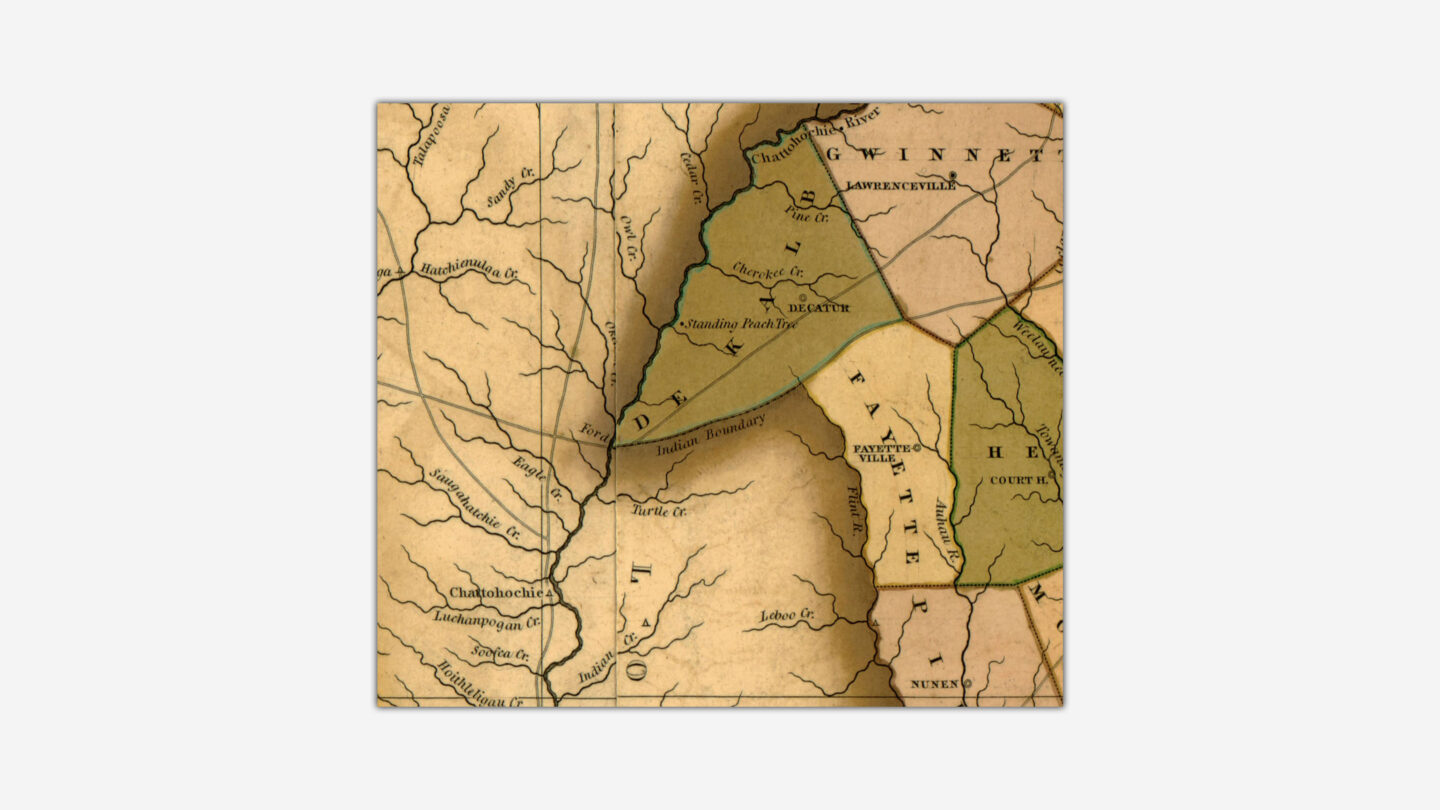
Standing Peachtree as charted on the H.S. Tanner map of Georgia, 1823.
In the War of 1812, the white settlers of Georgia were in direct conflict with the Muscogee, who allied with the British against the United States. The state of Georgia built a series of forts as bases from which to fight the Muscogee, including Fort Peachtree, which was built on high ground overlooking Standing Peachtree. The small outpost in northwest Georgia saw little action in the War of 1812 and served mostly as a stopover for those going west. By 1813, work was completed on a trail that connected Fort Peachtree to Fort Daniel, a similar outpost at Hog Mountain in Gwinnett County. This relatively insignificant road used the Muscogee trails as its course. It would eventually come to be called Peachtree Road. Today, it branches off from Peachtree Boulevard and as Old Peachtree Road runs north to the Fort Daniel Historic Site. The southern route of the Muscogee Peachtree Trail terminated at its junction with the Sandtown Trail at what is today Five Points.
Throughout the early 19th century, expanding white settlement pressed for more Indigenous land. Native territories were obtained by Georgia through a variety of means, including a series of treaty cessions often coerced or fraudulent. The First Treaty of Indian Springs, signed in 1821, resulted in the Muscogee Nation ceding 4 million acres east of the Flint River, including the future site of Atlanta. By the end of 1827, all Muscogee lands within the state of Georgia had been lost.
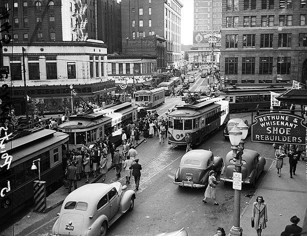
View looking south at the intersection of (north to south) Peachtree Street and Whitehall Street (later re-named Peachtree Street) and (west to east) Edgewood Avenue, Decatur Street, and Marietta Street in downtown Atlanta, Georgia. (Kenneth Rogers Photographs, Kenan Research Center at Atlanta History Center)
In 1837, the southern terminal of the Western & Atlantic Railroad was established about seven miles from Standing Peachtree and just a few steps from the end of the Peachtree Trail. As rail workers, settlers, and traders established homes and businesses in the town, the so-called “Terminus” became Marthasville in 1843. In 1845, Marthasville underwent a name change to become Atlanta. As Atlanta, the area developed into one of the South’s most vital economic crossroads. Its primary and most well-known street, established first by the Muscogee peoples, has become one – out of 71 – of the most famous streets in the world.