

Map highlighting prominent historic Black Atlanta neighborhoods. (“Lest We Forget: Atlanta’s Disappearing Black Neighborhoods” by Athlone G. Clarke)
City planner Leon Eplan said in 1985 in Race and The Shaping of 20th Century Atlanta, “There are virtually no major decisions that are made in the city of Atlanta that do not have a racial factor built into it. Everything has a racial component.” This statement was resoundingly true of the way Atlanta was rebuilt after Reconstruction and the echoes of residential segregation are visible today in its street names and neighborhoods.
After the Civil War, Blacks began moving to Atlanta in large numbers to pursue opportunities that allowed them to exercise their newly granted freedom, such as work, school, and community opportunities. Many also hoped to connect with children and other family members from whom they were separated by slavery.
At first, Blacks created their own communities, such as Reynoldstown, which was settled in 1870 by former slaves who worked for the railroad. When Blacks moved close to white areas, however, whites worked to create racial distance.
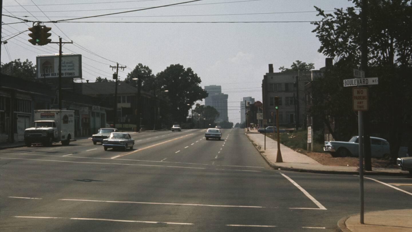
North Avenue looking west from Boulevard toward Life of Georgia Building (also known as One Georgia Center), C& S Bank, and First National Bank in Midtown. (VIS 139.116.55, Central Atlanta Progress, Inc. Photographs, Kenan Research Center at Atlanta History Center)
Sometimes the distance was superficial as is the case with some of Atlanta’s street names. For example, Moreland Avenue and Boulevard, two streets that frame Reynoldstown to the west and east have their names change to Briarcliff Road and Monroe Drive as you head north and cross Ponce de Leon Avenue. This was because white Atlantans did not want to share the same address as Blacks. Other streets where this phenomenon occurs are Parkway and Charles Allen Drives, Central Park Place and Argonne Avenue, and Courtland Street, which changes to Juniper Street as you drive north.
When obfuscation through name changes wasn’t enough, white Atlantans petitioned local policymakers, such as the mayor and city council, to enact physical barriers. Streets where Blacks lived that crossed into white neighborhoods were dead ended and roadblocks were erected. An infamous example of a physical blockade was the “Atlanta Wall.” That roadblock was erected in 1962 across Peyton Road in southwest Atlanta with permission from Mayor Ivan Allen Jr. The wooden barrier created a divide between the white and Black sections of Cascade Heights. It stood for 72 days and after gaining national attention was taken down.
Aerial view looking west at the construction of the Downtown Connector and Interstate in 1963. (VIS 109.01.22, Jack Etheridge Photographs of Downtown Atlanta, Georgia, Kenan Research Center at Atlanta History Center)
In the 1950s while planning I-20, Mayor William B. Hartsfield said he envisioned the corridor, which is the main east-west interstate in Atlanta, as a “boundary between the white and Negro communities.” In the 1960s as segments of the interstate were being built, the idea of the interstate being a racial dividing live was still the prevailing concept. In a 1960 report, the Atlanta Bureau of Planning stated that “there was an ‘understanding’ that the proposed route of the West Expressway [I-20 West] would be the boundary between white and Negro communities.”
Street sign at the intersection of United Avenue and Boulevard. (Rachel Singh)
Though examples of residential segregation are clearly visible in some of Atlanta’s street names and roadways, in recent years, the city has made strides to rectify perceived segregation. A notable example is the renaming of three Atlanta streets in Grant Park, Ormewood Park, and Woodland Hills that bore the word “Confederate.” The streets, though not named to celebrate the Civil War Confederacy per se (they got their names because a nursing home for Confederate veterans was in the area), still evoked memories of de facto racial segregation in the minds of some who lived nearby.
In a movement led by Black Atlantans, residents in the neighborhoods fought to change the names of Confederate Avenue, East Confederate Avenue, and Confederate Court. Under the grassroots campaign title “Neighbors for a New Name,” they successfully lobbied Atlanta City Council and the mayor’s office to change the street names. In 2018, Mayor Keisha Lance Bottoms signed a bill officially renaming the streets. In November 2019, Confederate Avenue became United Avenue; East Confederate Avenue became East United Avenue; and Confederate Court became Trestletree Court for the nearby apartment complex.